Detailed Point Weather Forecasts: How to Get Them When You Need Them
Alan Long1, Annie Oxarart2
1Tall Timbers Research Station and Land Conservancy, Tallahassee, Florida
2University of Florida, Gainesville, Florida
Publication ID: Fact Sheet 2011-1 Published: 2011 Revised: 2021, 2026
(View PDF)
Why Do I Need a Precise Weather Forecast?
Detailed point weather forecasts are a critical component of fire management planning. Accurate hour-by-hour forecasts for your exact location are valuable when you are preparing to ignite a prescribed burn and want to compare your prescription with actual conditions. They also provide important weather documentation for your files. They are equally important when you plan suppression strategies for an ongoing wildfire, organize mop-up or contingency forces, or decide where to take the kids fishing tomorrow. Precise weather forecasts help you plan for critical changes and thresholds in relative humidity, wind direction, temperature, and other key weather parameters.
Regional and local forecasts are available through sources such as the National Weather Service (NWS), National Oceanic and atmospheric Administration (NOAA) weather radio updates, The Weather Channel, and even local TV stations. Although these resources may provide hour-by-hour forecasts, they generally cover multi-county regions rather than being site specific. Several state forestry agencies, such as the Florida Forest Service and the NWS provide spot weather forecasts for specific locations through online protocols that require information about location and initial weather conditions. This factsheet highlights a simple procedure that is available through all local NWS websites for obtaining an hourly forecast for the next 48 hours (or longer) at any location in the South. All you need is internet access.
How Do I Get a Detailed Weather Forecast?
If you do not already have your local NWS office bookmarked on your web browser, locate it by going to the NWS homepage (www.weather.gov), enter the closest city or zip in the upper left searchbox, and press enter. Then follow these simple steps:
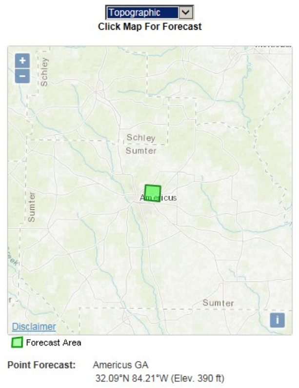
- On your local NWS office webpage, scroll down for a more detailed map that reads “Click a location for a detailed forecast.” Click again over your general location. The new page lists your approximate location at the top, which you can fine tune on the “Detailed Point Forecast” map near the bottom (right side) of the page (Figure 1).
- Once you have precisely pinpointed your fire location (or favorite fishing hole), click “Hourly Weather Graph” or “Tabular Forecast” under “Additional Forecasts & Information” in the lower center of the page.
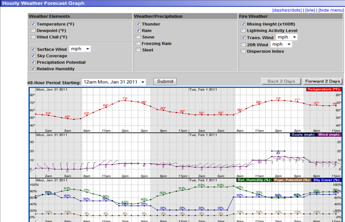
- The check boxes at the top of the graphs or table allow you to specify the particular elements and weather parameters you want to see, ranging from relative humidity to mixing height and transport speed.
- Hit the “Submit” button and the graphs or table will display the weather forecast at your exact location. The two screen captures in Figure 2 illustrate the graphs and table version of the same data.
Where Can I Get More Information About Fire Weather?
The NOAA Fire Weather website (www.weather.gov/fire), is another good source that has a wide variety of national and regional fire weather information. Definitions and descriptions of fire weather terms and concepts are also available in the Encyclopedia of Southern Fire Science (www.forestencyclopedia.net/p/p4/view). Advanced fire weather training is also available from the Wildland Safety Training Annual Refresher (WFSTAR) (https://www.nwcg.gov/publications/training-courses/rt-130) and the COMET MetEd website (www.meted.ucar.edu/).