Situational Awareness: Nighttime Smoke and Fog on Prescribed Burns
Anthony Matthews1, Vince Carver2
1United States Forest Service
2United States Fish and Wildlife Service
Publication ID: Fact Sheet 2011-2 Published: 2011 Revised: 2021, 2026
(View PDF)
Introduction
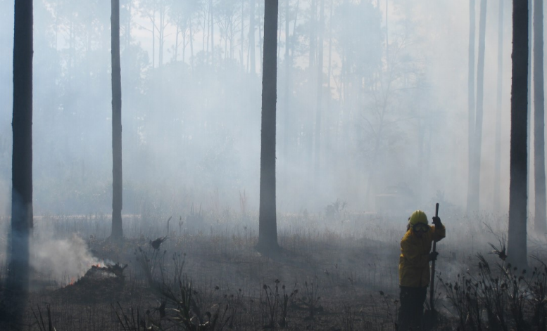
Nighttime smoke dispersal from most prescribed fires is critical for public health and safety. For this reason, prescribed fire training and guidelines include detailed information about smoke management and remind burn managers to be constantly aware of weather, fuel, and other situations that might lead to smoke dispersion problems. Nonetheless, it is easy to overlook a small detail that can lead to problems later. This fact sheet lists situations or conditions that agency administrators, fire management officers, burn bosses, and landowners should pay attention to when planning and implementing prescribed burns. Answering “yes” to the following questions indicates a need to strengthen or modify plans and mitigation measures. This fact sheet is one tool for fire managers to use in designing and conducting an effective and efficient smoke management strategy on prescribed burns. It supplements, but does not replace, the smoke screening systems and details described in the references on the next page. Refer to these sources if you are unsure about what to do if you have “yes” answers.
Planning the Burn
- Are ignition activities, active burning, or smoldering planned during the period “1-hour prior to sunset to 1-hour after sunrise” when smoke problems are most likely to occur?
- Are smoke sensitive sites, especially highways, “down-drainage” from the burn and within a distance that smoke can “flow” to during the night (2-10+ miles)? Remember, the steeper the topography, the further smoke can travel.
- Are openings (e.g., fields, power lines) next to the burn that could funnel smoke toward a highway or other smoke sensitive area?
- Is open water within or adjacent to the burn (e.g., streams, rivers, lakes, ponds, canals)?
- Will the burn occur when the potential for fog is high? Remember, the highest potential for fog typically occurs from late fall to late spring, when ground and water temperatures remain warmer than the cooling air temperature, creating conditions conducive for fog.
- Is there potential for any of the following local weather phenomena to affect the burn?
- Sea breezes
- Fog formed over nearby cool ground or water surfaces
- “Atmospheric walls” that can form over water and cause smoke to concentrate over the coastline
- Mountain inversions
- Does the burn unit contain pockets of heavy fuels (e.g., hurricane damage, fallen beetle-killed timber, logging slash) that could burn and smolder for long periods?
- Is there a heavy duff layer or organic soil which could smolder for long periods if ignited?
- Is the burn unit large with few options to effectively stop the burn if things don’t go as planned?
Implementing the Burn
- Does the spot weather forecast warn of potential fog (usually included in the narrative)?
- Is either of the following forecast indices in the range that indicates potential problems with nighttime smoke?
- LVORI (Low Visibility Occurrence Risk Index) greater than 5
- Nighttime dispersion index less than 4 (or 40, depending on scale)
- Are dew point and temperature predicted to move to within a few degrees of each other during the evening hours (i.e., high relative humidity and potential for fog)?
- Are you relying on predicted nighttime winds to continue dispersing smoke? Remember that
- Nighttime smoke typically has no buoyancy to gain vertical lift and be influenced by upper winds; and
- Regardless of forecasts, surface winds at night tend to be calm to light and variable, resulting in down-drainage movement of smoke.
- Is the smoke from the burn not dispersing as forecasted?
- Do any of the following National Fire Danger Rating System (NFDRS) indices fall within the stated range, indicating that heavy fuels may ignite and smolder?
- 100 hour fuel moistures less than 14 percent
- 1000 hour fuel moistures less than 19 percent
- KBDI (Keetch-Byram Drought Index) greater than 400
- Are snags and heavy fuels igniting unexpectedly?
- Are equipment breakdowns or changes in firing patterns causing ignition delays and increasing the risk of active burning and smoldering into nighttime hours?
- Are other burns occurring in the same airshed, potentially increasing nighttime smoke dispersion issues?
- Has a “new” event/activity resulted in a nearby area unexpectedly becoming a smoke sensitive site?
Where Can You Get More Information About Smoke Management?
Several state forestry agency webpages include smoke management information. For example, the South Carolina Forestry Commission has Smoke Management Guidelines (www.state.sc.us/forest/smg05.pdf), and the Florida Forest Service has their older simple smoke screening tool (http://fireweather.fdacs.gov/Simple-Smoke/) along with their newer smoke screening tool (http://fireinfo.fdacs.gov/fmis.sst/). In addition, a variety of resources are available to help understand smoke transport principles, smoke management guidelines, and practices to minimize smoke-related problems.
- Encyclopedia of Southern Fire Science. Available at: www.forestencyclopedia.net/p/p137/view.
- Managing Smoke at the Wildland-Urban Interface, 2007, Wade & Mobley, USDA Forest Service GTR SRS-103. Available at: www.srs.fs.fed.us/pubs/28550.
- Introduction to Prescribed Fire in Southern Ecosystems, 2012, Waldrop & Goodrick, USDA Forest Service Science Update GTR SRS-054. Available at: www.srs.fs.usda.gov/pubs/41316.
- Southern Forestry Smoke Management Guidebook, 1976, USDA Forest Service GTR SE-10. Available at www.treesearch.fs.fed.us/pubs/683.
- Smoke Management for Prescribed Burning, 2009, Weir & Carlson, Oklahoma State University Cooperative Extension Service Circular E-1008. Available at: http://pods.dasnr.okstate.edu/docushare/dsweb/Get/Document-5672/E-1008%20Smoke%20Management.pdf