It is expected that changes to the National Ambient Air Quality Standards for PM2.5 will require state and federal agencies to assemble and submit Exceptional Events reports for certain prescribed fires under the Clean Air Act section 319(b). The EPA has developed guidance and additional resources for Exceptional Events documentation available here.
On this page, we have curated a list of additional resources that may support Exceptional Events documentation. If you have resources that we should consider including here, please email us ([email protected]).
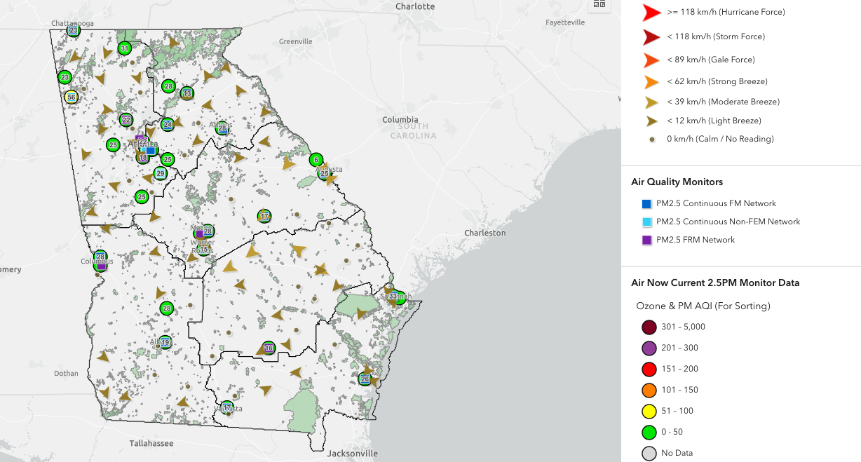
Georgia DNR Winds and Air Quality Map
Georgia DNR Winds and Air Quality Monitors Map – This map provides an easy way to view air quality monitor locations, current PM 2.5 AQI levels, and surface wind observations.
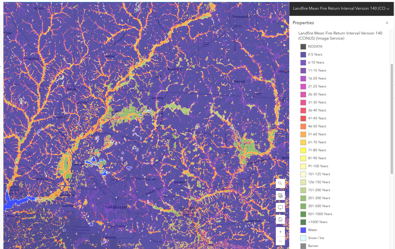
USDA Forest Service LANDFIRE Fire Return Interval Map
USDA Forest Service LANDFIRE Mean Fire Return Interval CONUS Map – Some organizations are looking for resources to determine and document the historical fire return interval for a prescribed burn unit. This ESRI online map interface allows you to zoom in on any particular location within the lower 48 states to find the LANDFIRE-based approximate fire return interval (FRI).
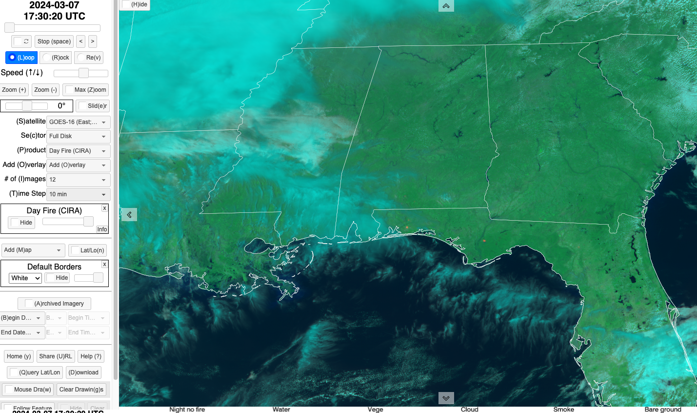
Regional and Mesoscale Meteorology Branch GOES-16 Satellite Imagery
Satellite imagery is often used to track and identify smoke movement at the regional and national scales. The CIRA / RAMMB slider page allows you to customize GOES-16 views and export animations of cloud and smoke movement.
GOES Image and Animation Viewer
The NOAA GOES Image Viewer allows you to customize and download high-resolution GOES 5-minute satellite imagery and animations. The viewer includes options for various multispectral band combinations.
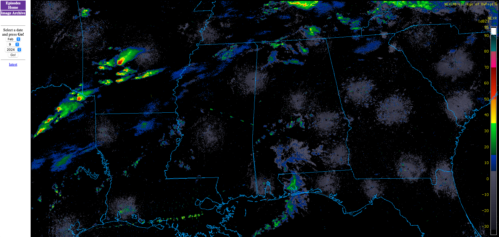
NCAR Nexrad Radar Archive
The National Center for Atmospheric Research (NCAR) hosts an archive of national NEXRAD radar data. The available data varies by location and date, but some images going back to 1996 are available. NEXRAD radar imagery can capture some wildfire and prescribed fire smoke columns, particularly when there is significant vertical development of the smoke column.
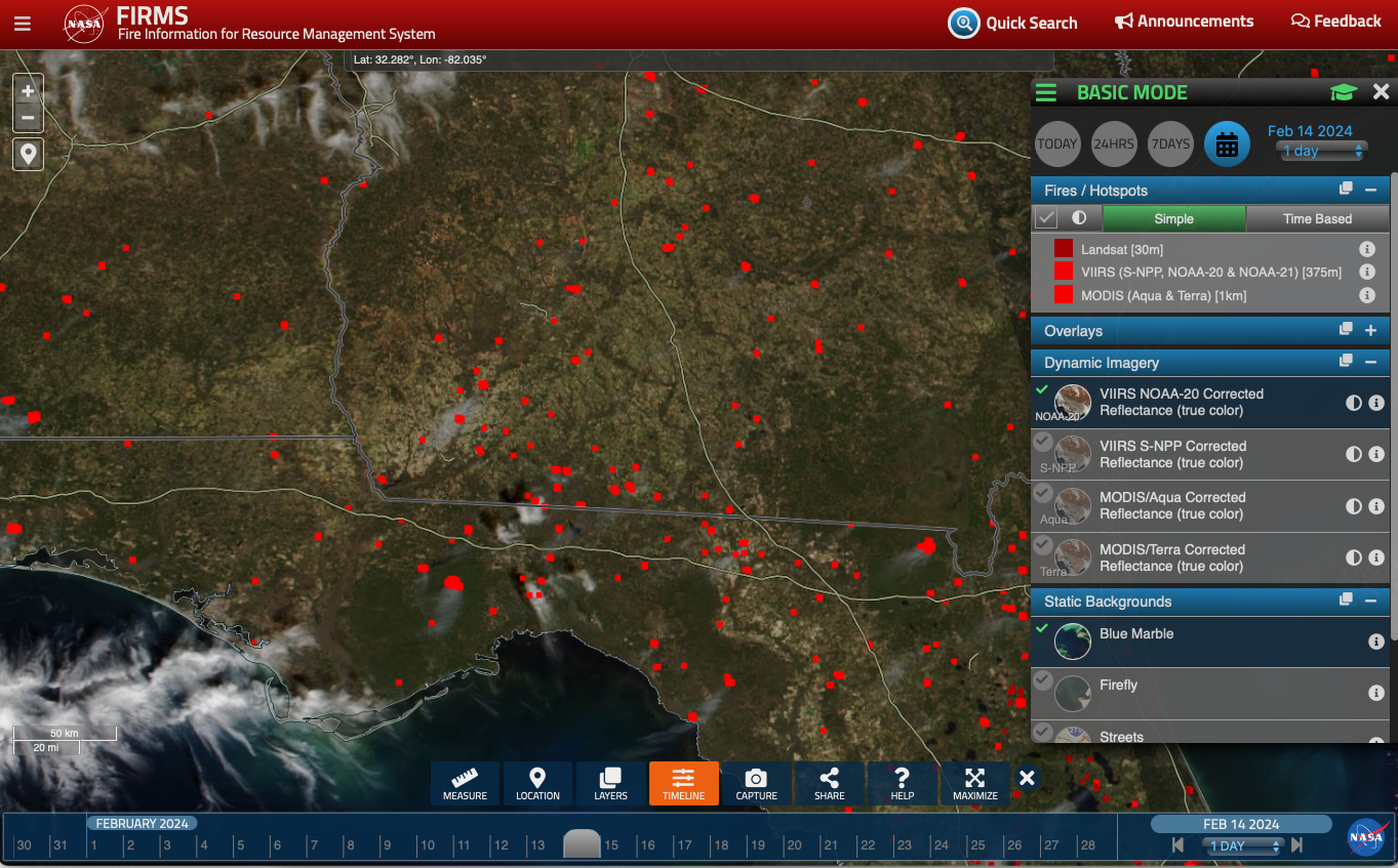
NASA Fire Information for Resource Management System (FIRMS)
The NASA Fire Information for Resource Management System (FIRMS) is an interactive interface and archive of satellite fire detections (MODIS, Landsat, VIIRS) and satellite imagery. The FIRMS system can provide an overview of satellite-detected fires as well as visible smoke plume movement.