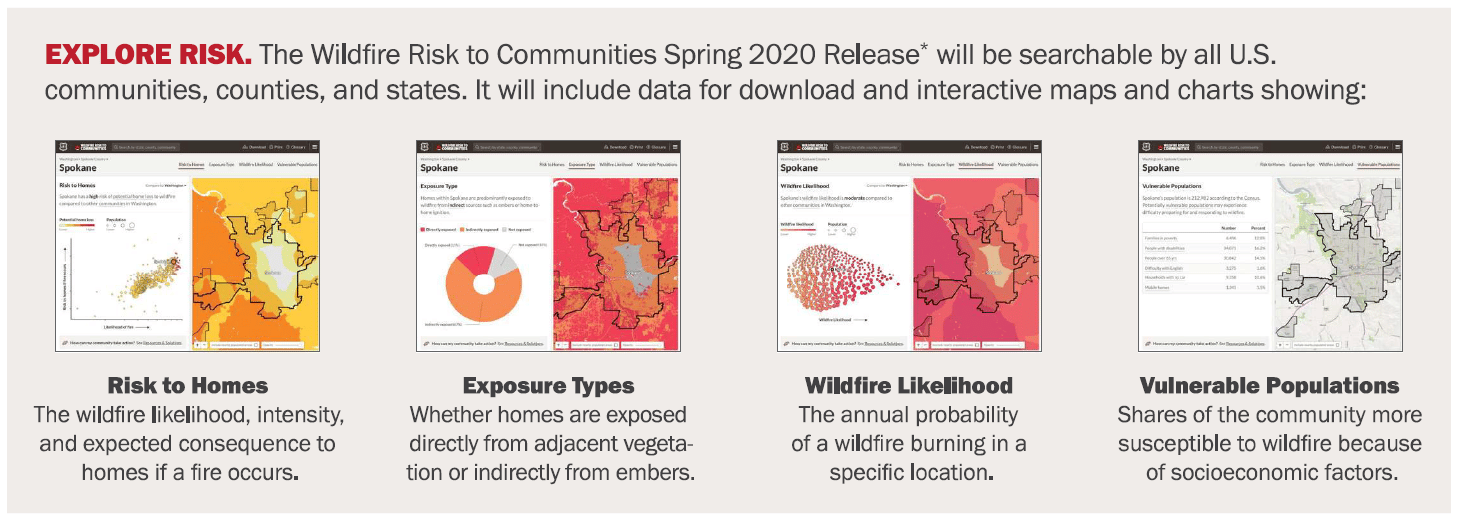
 The brand new Wildfire Risk to Communities interactive map and data visualization tool provides individuals, communities, leaders, agencies and cooperatives seamless wildfire risk information for all 50 states. The interactive browser-based map data and reports are available at the community, county and state levels. The tool is intended to provide citizens and decision makers with information that can help them to understand wildfire risk based on hazards and vulnerabilities. This information can assist with scenario planning, fuel treatment prioritization and a wide array of fire adapted community related processes. Wildfire mitigation specialists will definitely want to check out this resource.
Call for Applications: EFNet Graduate Research Experience on WUI
Call for Applications: EFNet Graduate Research Experience on the WUI The Eastern Fire Network (EFNet) recently announced a call for applications for their summer ...
New Fire Lines Newsletter (vol. 15 is. 8)
New Fire Lines Newsletter: Volume 15, Issue 8 The latest issue (Volume 15, Issue 8) of the Southern Fire Exchange “Fire Lines” newsletter has ...

New Fire Lines Newsletter (vol. 15 is. 7)
New Fire Lines Newsletter: Volume 15, Issue 7 The latest issue (Volume 15, Issue 7) of the Southern Fire Exchange “Fire Lines” newsletter has ...