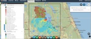
NIDIS Launches New Interactive Maps on Drought.gov
NIDIS has released two new interactive features on Drought.gov that will make it easier for decision makers and the public across the U.S. to share timely, reliable drought information. First, new customization and